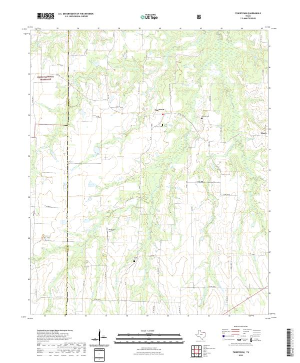
2022 Map of Tigertown
USGS Topo · Published 2022About this map
Caddo National Grassland segments define the western border of this region in Lamar County, where the landscape transitions into a network of creek drainages. The small community of Tigertown serves as a central point, situated near several family and community landmarks including Tigertown Cem and Strother Cem. To the southeast, the settlement of Maxey sits near the headwaters of Maxey Cr, illustrating the historical pattern of placing rural outposts along elevated ground between the many winding waterways like Sanders Cr and Cottonwood Cr. Private aviation and local infrastructure are represented by the Forest Hill Airport and the nearby Forest Hill Cem, providing specific points of interest for genealogists tracing family names and burial sites in this part of Texas. The map detail highlights a rural economy still organized around a dense grid of county roads and established farm-to-market routes.
Find a feature on this map
58 named features on this map. Tap any name to fly to it.
Don’t see what you’re looking for? This feature index may not catch every label — zoom into the map to look around manually.
Map Details
Editions of this 2022 Tigertown Map
This is the sole edition of this map. No revisions or reprints were ever made.
Other maps of this area

1903 · Paris
USGS Topo · 1:125,000

1947 · Honey Grove
USGS Topo · 1:62,500

1948 · Grant
USGS Topo · 1:62,500

1948 · Paris
USGS Topo · 1:62,500

1948 · Direct
USGS Topo · 1:62,500

1949 · Direct
USGS Topo · 1:62,500

1949 · Honey Grove
USGS Topo · 1:62,500

1949 · Grant
USGS Topo · 1:62,500

1949 · Paris
USGS Topo · 1:62,500

1953 · Texarkana
USGS Topo · 1:250,000