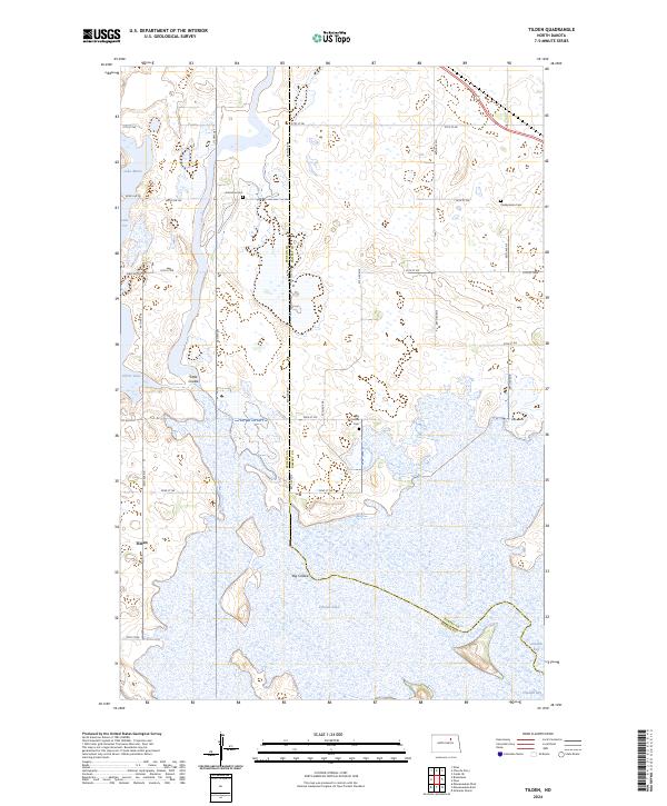
2024 Map of Tilden
USGS Topo · Published 2024About this map
Pelican Lake and the winding course of Big Coulee dominate this landscape on the border of Ramsey and Benson counties. This region is defined by its extensive protected wetlands, including the Silver Lake National Wildlife Refuge and large swaths of the Ramsey County Waterfowl Production Area. The small settlement of Tilden sits near the western edge, connected by a grid of rural roads like US Hwy 281 and Co Rd 0314.
Find a feature on this map
37 named features on this map. Tap any name to fly to it.
Don’t see what you’re looking for? This feature index may not catch every label — zoom into the map to look around manually.
Map Details
Editions of this 2024 Tilden Map
This is the sole edition of this map. No revisions or reprints were ever made.
Other maps of this area

1932 · Grahams Island
USGS Topo · 1:62,500

1950 · Grahams Island
USGS Topo · 1:62,500

1951 · Grahams Island
USGS Topo · 1:24,000

1951 · Tilden
USGS Topo · 1:24,000

1951 · Minnewaukan East
USGS Topo · 1:24,000

1951 · Penn
USGS Topo · 1:24,000

1953 · Devils Lake
USGS Topo · 1:250,000

1956 · Devils Lake
USGS Topo · 1:250,000

1956 · Brinsmade
USGS Topo · 1:24,000

1957 · Cando SE
USGS Topo · 1:24,000