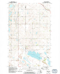
1994 Map of Tilden
USGS Topo · Published 1994About this map
Pelican Lake and the surrounding prairie wetlands dominate this landscape on the border of Benson and Ramsey Counties. In the mid-1990s, the region was defined by its conservation areas, including the Silver Lake National Wildlife Refuge and the National Waterfowl Production Area, reflecting the importance of the Central Flyway. The small settlements of Tilden and Penn anchor the local community, which is connected by the Soo Line railroad. Rural life is further mapped through landmarks such as the townhall in Tilden and several religious centers including Antiochia Ch and Big Coulee Ch, along with the Presbyterian Cem. The presence of a Gaging Station and various coulees like Big Coulee and Little Coulee highlights the intricate hydrologic network of this North Dakota prairie pothole region.
Find a feature on this map
27 named features on this map. Tap any name to fly to it.
Don’t see what you’re looking for? This feature index may not catch every label — zoom into the map to look around manually.
Map Details
Editions of this 1994 Tilden Map
This is the sole edition of this map. No revisions or reprints were ever made.
Other maps of this area

1932 · Grahams Island
USGS Topo · 1:62,500

1950 · Grahams Island
USGS Topo · 1:62,500

1951 · Grahams Island
USGS Topo · 1:24,000

1951 · Tilden
USGS Topo · 1:24,000

1951 · Minnewaukan East
USGS Topo · 1:24,000

1951 · Penn
USGS Topo · 1:24,000

1953 · Devils Lake
USGS Topo · 1:250,000

1956 · Devils Lake
USGS Topo · 1:250,000

1956 · Brinsmade
USGS Topo · 1:24,000

1957 · Cando SE
USGS Topo · 1:24,000