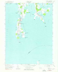
1942 Map of Tilghman
USGS Topo · Published 1976About this map
Tilghman Island anchors this coastal survey, illustrating the maritime character of the Maryland Eastern Shore during the early 1940s. The geography is defined by a intricate network of waterways, where Dogwood Harbor and Knapps Narrows serve as vital conduits for the local watermen. The primary settlements of Tilghman, Avalon, and Fairbank are clustered along the island's narrow spine, while across Harris Creek to the east, the village of Neavitt sits amidst a landscape of points and coves like Balls Creek and Turkey Neck Point. The southern tip terminates at the sharp profile of Blackwalnut Point, marking the entrance to the Choptank River. This map preserves the mid-century layout of these fishing and boat-building communities before modern development changed the traditional waterfront, documenting the various landings and small roads that linked these isolated peninsula villages to the mainland and the Chesapeake Bay.
Find a feature on this map
39 named features on this map. Tap any name to fly to it.
Don’t see what you’re looking for? This feature index may not catch every label — zoom into the map to look around manually.
Map Details
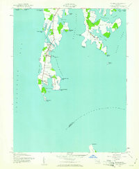
Editions of this 1942 Tilghman Map
Other maps of this area

1892 · Annapolis
USGS Topo · 1:62,500

1893 · Sharps Island
USGS Topo · 1:62,500

1898 · Choptank
USGS Topo · 1:125,000

1904 · St. Michaels
USGS Topo · 1:62,500

1904 · Annapolis
USGS Topo · 1:62,500

1904 · Sharps Island
USGS Topo · 1:62,500

1904 · Oxford
USGS Topo · 1:62,500

1908 · Choptank
USGS Topo · 1:125,000

1942 · Tilghman
USGS Topo · 1:31,680

1942 · Oxford
USGS Topo · 1:31,680