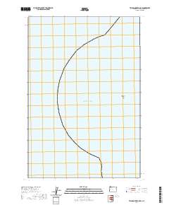
2020 Map of Tillamook Head OE W
USGS Topo · Published 2020About this map
Tillamook Rock stands as a solitary landmark within the vast expanse of the Pacific Ocean on this coastal maritime survey. This specific area of the Clatsop County coastline is dominated by open water and defined by the intricate public land survey system divisions. The map delineates precise maritime boundaries and land sections such as t6n r11w and t5n r11w, which are essential for understanding the administrative and historical property lines along the Oregon shore. While largely focused on the seascape, the inclusion of the isolated rock formation provides a critical point of reference for navigators and historians interested in the rugged Pacific Northwest maritime environment in the early twenty-first century.
Find a feature on this map
30 named features on this map. Tap any name to fly to it.
Don’t see what you’re looking for? This feature index may not catch every label — zoom into the map to look around manually.
Map Details
Editions of this 2020 Tillamook Head OE W Map
This is the sole edition of this map. No revisions or reprints were ever made.
Other maps of this area

1919 · Astoria
USGS Topo · 1:62,500

1939 · Astoria
USGS Topo · 1:62,500

1940 · Cape Falcon
USGS Topo · 1:62,500

1943 · Copalis Beach
USGS Topo · 1:250,000

1948 · Vancouver
USGS Topo · 1:250,000

1949 · Tillamook Head
USGS Topo · 1:24,000

1949 · Gearhart
USGS Topo · 1:24,000

1950 · Vancouver
USGS Topo · 1:250,000

1950 · Vancouver
USGS Topo · 1:250,000

1951 · Copalis Beach
USGS Topo · 1:250,000