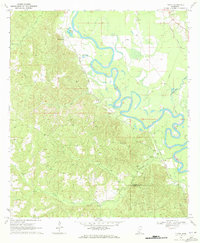
1970 Map of Tilton
USGS Topo · Published 1972About this map
The Pearl River snakes through the heart of this 1970 Lawrence County survey, defining the landscape with its tight meanders and oxbows like Wilsons Lake. The river corridor acts as a dividing line between the concentrated rail infrastructure to the east and the undulating, wooded terrain to the west. Two major railroads, the Illinois Central and the Gulf Mobile and Ohio, parallel the river's course, signaling the region's historical reliance on transit for timber and agriculture.
Find a feature on this map
22 named features on this map. Tap any name to fly to it.
Don’t see what you’re looking for? This feature index may not catch every label — zoom into the map to look around manually.
Map Details
Editions of this 1970 Tilton Map
This is the sole edition of this map. No revisions or reprints were ever made.
Other maps of this area

1953 · Hattiesburg
USGS Topo · 1:250,000

1953 · Natchez
USGS Topo · 1:250,000

1956 · Natchez
USGS Topo · 1:250,000

1958 · Hattiesburg
USGS Topo · 1:250,000

1959 · Natchez
USGS Topo · 1:250,000

1970 · Prentiss West
USGS Topo · 1:24,000

1970 · Topeka
USGS Topo · 1:24,000

1970 · Monticello
USGS Topo · 1:24,000

1970 · Darbun
USGS Topo · 1:24,000

1970 · Morgantown
USGS Topo · 1:24,000