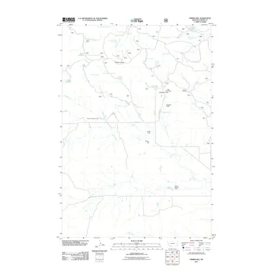
2011 Map of Timber Hill
USGS Topo · Published 2011About this map
Belltower Divide serves as a prominent geographic spine in this section of Carter County, separating the drainages that feed into Speelmon Creek and Plum Creek. The landscape is defined by its water management and livestock infrastructure, marked by numerous named springs such as Icebox Spring, Ballinger Spring, and the multi-part Maverick Spring Number 1. These reliable water sources supported ranching operations across the high plains, as evidenced by the distribution of reservoirs like Brewer Reservoir and Gergen Reservoir. Local history is anchored at the Pioneer Cemetery, which sits near Big Tree Draw. The map reveals a network of essential roads, including Tie Creek Rd and Chimney Rock Rd, which connect the isolated draws and timbered ridges that give Timber Hill its name.
Find a feature on this map
42 named features on this map. Tap any name to fly to it.
Don’t see what you’re looking for? This feature index may not catch every label — zoom into the map to look around manually.
Map Details
Editions of this 2011 Timber Hill Map
This is the sole edition of this map. No revisions or reprints were ever made.
Other maps of this area

1954 · Ekalaka
USGS Topo · 1:250,000

1956 · Ekalaka
USGS Topo · 1:250,000

1958 · Ekalaka
USGS Topo · 1:250,000

1965 · Ekalaka
USGS Topo · 1:250,000
1980 · Belltower
USGS Topo · 1:24,000
1980 · Capitol Rock
USGS Topo · 1:24,000
1980 · Rustler Divide
USGS Topo · 1:24,000
1980 · Belltower Butte
USGS Topo · 1:24,000
1980 · Capitol NW
USGS Topo · 1:24,000
1980 · Lone Tree Creek
USGS Topo · 1:24,000