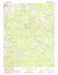
1990 Map of Timber Knob
USGS Topo · Published 1990About this map
The Strawberry Mine and scattered Prospects signify the extractive history of this high-altitude landscape within the Sierra National Forest. This 1990 provisional survey records a rugged transition between the Ansel Adams Wilderness and the eastern edge of Yosemite National Park. Human activity is concentrated along the southern corridor where Beasore Road provides access to the Clover Meadow Ranger Station and various recreational sites including the Clover Meadow Campground.
Find a feature on this map
56 named features on this map. Tap any name to fly to it.
Don’t see what you’re looking for? This feature index may not catch every label — zoom into the map to look around manually.
Map Details
Editions of this 1990 Timber Knob Map
This is the sole edition of this map. No revisions or reprints were ever made.
Other maps of this area

1901 · Mt. Lyell
USGS Topo · 1:125,000

1904 · Kaiser
USGS Topo · 1:125,000

1947 · Mariposa
USGS Topo · 1:250,000

1948 · Mariposa
USGS Topo · 1:250,000

1953 · Merced Peak
USGS Topo · 1:62,500

1953 · Devils Postpile
USGS Topo · 1:62,500

1953 · Shuteye Peak
USGS Topo · 1:62,500

1953 · Kaiser Peak
USGS Topo · 1:62,500

1957 · Mariposa
USGS Topo · 1:250,000

1963 · Mariposa
USGS Topo · 1:250,000