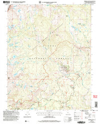
2004 Map of Timber Knob
USGS Topo · Published 2007About this map
Ansel Adams Wilderness and the southern edge of Yosemite Wilderness define this high-altitude landscape in the Sierra National Forest. The map documents a terrain defined by glacial basins and alpine meadows, including Clover Meadow and Jackass Meadow, which serve as hubs for high-country travel. The presence of the Minarets Pack Station and various prospects near Strawberry Mine reflect the area's dual history of recreational guiding and mineral exploration.
Find a feature on this map
61 named features on this map. Tap any name to fly to it.
Don’t see what you’re looking for? This feature index may not catch every label — zoom into the map to look around manually.
Map Details
Editions of this 2004 Timber Knob Map
This is the sole edition of this map. No revisions or reprints were ever made.
Other maps of this area

1901 · Mt. Lyell
USGS Topo · 1:125,000

1904 · Kaiser
USGS Topo · 1:125,000

1947 · Mariposa
USGS Topo · 1:250,000

1948 · Mariposa
USGS Topo · 1:250,000

1953 · Merced Peak
USGS Topo · 1:62,500

1953 · Devils Postpile
USGS Topo · 1:62,500

1953 · Shuteye Peak
USGS Topo · 1:62,500

1953 · Kaiser Peak
USGS Topo · 1:62,500

1957 · Mariposa
USGS Topo · 1:250,000

1963 · Mariposa
USGS Topo · 1:250,000