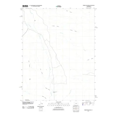
2010 Map of Timber Mountain
USGS Topo · Published 2010About this map
Kathryn Number Two Incline Mine and Avery Mine highlight the industrial history of this section of El Paso County. The landscape is defined by a network of drainage systems, including Turkey Creek and Wild Horse Creek, which have carved several notable landforms into the terrain. Significant elevation markers like Timber Mountain, Buck Hill, and Booth Mountain anchor the western portion of the map, while numerous canyons such as Crooked Canyon and Orchard Canyon provide insight into the natural geological drainage patterns of the area. This 2010 survey reflects a period when the land was primarily used for resource extraction and rural surveying, evidenced by the presence of named mines and the clear delineation of topographic features like Rule Canyon and Sand Canyon.
Find a feature on this map
15 named features on this map. Tap any name to fly to it.
Don’t see what you’re looking for? This feature index may not catch every label — zoom into the map to look around manually.
Map Details
Editions of this 2010 Timber Mountain Map
This is the sole edition of this map. No revisions or reprints were ever made.
Other maps of this area

1891 · Pueblo
USGS Topo · 1:125,000

1893 · Colorado Springs
USGS Topo · 1:125,000

1894 · Pueblo
USGS Topo · 1:125,000

1896 · Pueblo
USGS Topo · 1:125,000

1897 · Pueblo
USGS Topo · 1:125,000

1909 · Colorado Springs
USGS Topo · 1:125,000

1942 · Colorado Springs
USGS Topo · 1:125,000

1948 · Mount Big Chief
USGS Topo · 1:24,000

1948 · Mount Pittsburg
USGS Topo · 1:24,000

1948 · Timber Mountain
USGS Topo · 1:24,000