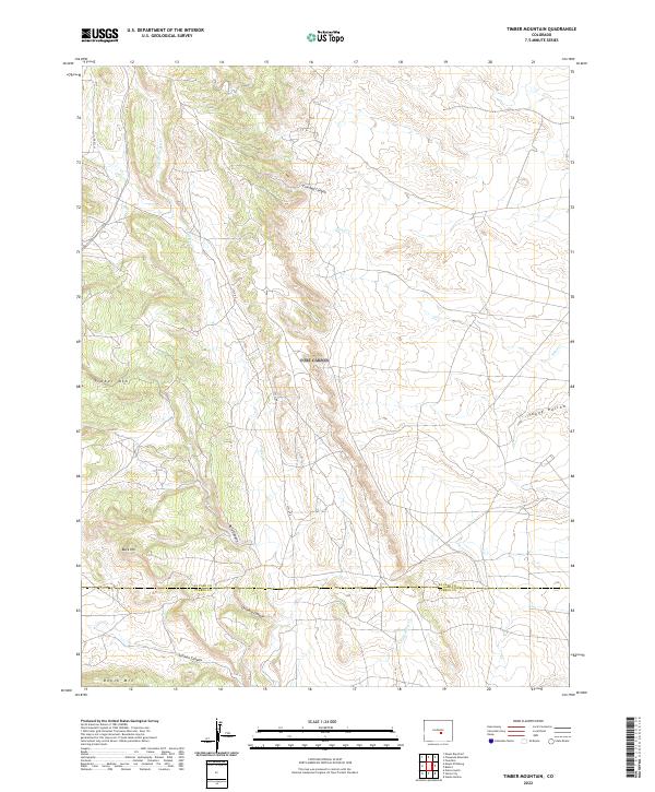
2022 Map of Timber Mountain
USGS Topo · Published 2022About this map
Timber Mountain and the surrounding high country along the El Paso and Pueblo county line are defined by a complex network of drainages and prominent peaks. This modern survey illustrates the rugged transition from the heights of Timber Mountain and Buck Hill down through deeply carved terrain such as Crooked Canyon and Orchard Canyon. The landscape is etched by intermittent watercourses including Turkey Creek and Wild Horse Creek, showing how the land breaks away into the Sand Creek basin. Human footprint remains minimal in this portion of the Front Range, primarily marked by the presence of Lytle Road and scattered survey sections. The map provides a clear look at the geological features that have long influenced movement through this territory, from the steep walls of Rule Canyon to the southern slopes of Booth Mountain.
Find a feature on this map
20 named features on this map. Tap any name to fly to it.
Don’t see what you’re looking for? This feature index may not catch every label — zoom into the map to look around manually.
Map Details
Editions of this 2022 Timber Mountain Map
This is the sole edition of this map. No revisions or reprints were ever made.
Other maps of this area

1891 · Pueblo
USGS Topo · 1:125,000

1893 · Colorado Springs
USGS Topo · 1:125,000

1894 · Pueblo
USGS Topo · 1:125,000

1896 · Pueblo
USGS Topo · 1:125,000

1897 · Pueblo
USGS Topo · 1:125,000

1909 · Colorado Springs
USGS Topo · 1:125,000

1942 · Colorado Springs
USGS Topo · 1:125,000

1948 · Mount Big Chief
USGS Topo · 1:24,000

1948 · Mount Pittsburg
USGS Topo · 1:24,000

1948 · Timber Mountain
USGS Topo · 1:24,000