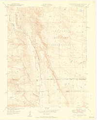
1949 Map of Timber Mountain
USGS Topo · Published 1949About this map
Camp Carson Military Reservation dominates the northeastern landscape of this 1949 survey, representing a significant period of mid-century military expansion in southern Colorado. The terrain is defined by a series of dramatic drainages and peaks, including Timber Mountain and Buck Hill, which are carved by Crooked Canyon and Rule Canyon. The map reveals a transition from these high features down to the Turkey Creek drainage, where small-scale agrarian footprints like Earley Ranch and Avery Ranch persist alongside the military boundary. These family names and the presence of the Lytle Sch suggest a rural community structure that was increasingly impacted by federal land use. To the south, the El Paso Co Pueblo Co line marks the administrative divide amidst a rugged network of paths such as Lytle Road and several smaller canyons like Orchard Canyon and Sullivan Canyon.
Find a feature on this map
21 named features on this map. Tap any name to fly to it.
Don’t see what you’re looking for? This feature index may not catch every label — zoom into the map to look around manually.
Map Details
Editions of this 1949 Timber Mountain Map
2 editions found

Other maps of this area

1891 · Pueblo
USGS Topo · 1:125,000

1893 · Colorado Springs
USGS Topo · 1:125,000

1894 · Pueblo
USGS Topo · 1:125,000

1896 · Pueblo
USGS Topo · 1:125,000

1897 · Pueblo
USGS Topo · 1:125,000

1909 · Colorado Springs
USGS Topo · 1:125,000

1942 · Colorado Springs
USGS Topo · 1:125,000

1948 · Mount Big Chief
USGS Topo · 1:24,000

1948 · Mount Pittsburg
USGS Topo · 1:24,000

1948 · Timber Mountain
USGS Topo · 1:24,000