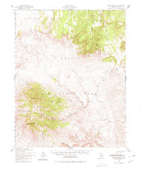
1952 Map of Timber Mountain
USGS Topo · Published 1980About this map
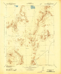
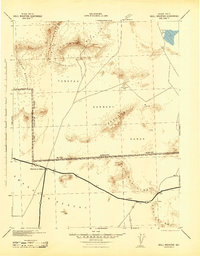
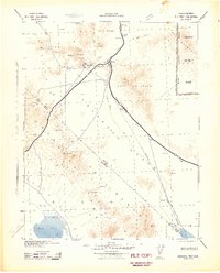
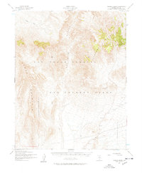
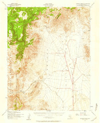
Nellis Air Force Base dominates the landscape of this mid-century survey, a region defined by high desert topography and massive geologic formations in southern Nevada. The central feature, Timber Mountain, rises sharply with distinct summits at North Timber Peak and South Timber Peak, surrounded by a complex system of drainage channels including Fortymile Canyon and West Cat Canyon. To the north, the broad expanse of Pahute Mesa gives way to a series of prominent ridges such as Split Ridge and Falcon Ridge, which flank the deep incision of Silent Canyon. The map reveals a land utilized for military operations during the early Cold War era, evidenced by the restricted base boundaries and landmarks like Stockade Wash and Big Burn Valley. This document provides an essential topographic record of the area's natural drainage patterns and landforms before subsequent development or modifications to the test range landscape.
Find a feature on this map
21 named features on this map. Tap any name to fly to it.
Don’t see what you’re looking for? This feature index may not catch every label — zoom into the map to look around manually.
Map Details
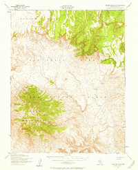
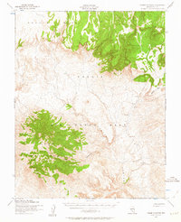
Editions of this 1952 Timber Mountain Map
3 editions found
Other maps of this area

1908 · Kawich
USGS Topo · 1:250,000

1908 · Furnace Creek
USGS Topo · 1:250,000

1910 · Furnace Creek
USGS Topo · 1:250,000
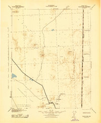
1942 · Tolicha Peak
USGS Topo · 1:125,000
1942 · Wheelbarrow Peak
USGS Topo · 1:125,000
1942 · Skull Mountain
USGS Topo · 1:125,000
1942 · Bullfrog
USGS Topo · 1:125,000

1948 · Death Valley
USGS Topo · 1:250,000
1952 · Topopah Spring
USGS Topo · 1:62,500
1952 · Tippipah Spring
USGS Topo · 1:62,500