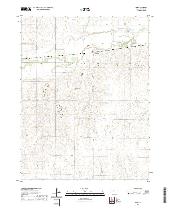
2022 Map of Timken
USGS Topo · Published 2022About this map
Timken serves as the primary hub of this Rush County landscape, situated along the northern banks of Walnut Cr. The settlement's layout is defined by the intersection of Main St and S Railroad Ave, reflecting a development pattern common to the grain-producing regions of central Kansas. To the south, the terrain becomes increasingly dissected by numerous watercourses, including Dry Cr and Dry Walnut Cr, which carve through the plains. Local heritage is anchored by two notable burial grounds, Bohemian Cem and Holy Cross Cem, which offer significant value for genealogists tracing the Central European ancestry of the area's early farming families. The map clearly delineates the section lines and township boundaries, such as t18s r17w, that have governed land ownership and agricultural organization in this part of Kansas for over a century.
Find a feature on this map
32 named features on this map. Tap any name to fly to it.
Don’t see what you’re looking for? This feature index may not catch every label — zoom into the map to look around manually.
Map Details
Editions of this 2022 Timken Map
This is the sole edition of this map. No revisions or reprints were ever made.
Other maps of this area

1889 · Larned
USGS Topo · 1:125,000

1891 · Larned
USGS Topo · 1:125,000

1896 · Hays
USGS Topo · 1:125,000

1955 · Great Bend
USGS Topo · 1:250,000

1957 · Great Bend
USGS Topo · 1:250,000

1958 · Great Bend
USGS Topo · 1:250,000
1965 · Otis
USGS Topo · 1:24,000
1965 · Albert
USGS Topo · 1:24,000

1966 · Rush Center
USGS Topo · 1:24,000

1966 · La Crosse
USGS Topo · 1:24,000