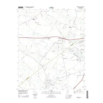
2014 Map of Timmonsville
USGS Topo · Published 2014About this map
The town of Timmonsville anchors the southern portion of this South Carolina landscape, where the municipal grid meets the open reaches of Lake Swamp and Sparrow Swamp. This survey documents a rural environment shaped by drainage systems and family-named intersections, notably the series of crossroads—Jackson Crossroads, Wallace Crossroads, and Alexander Crossroads—that define local transit and community points. To the north, the land is etched by Jeffries Cr and High Hill Cr, while the central region is marked by the expansive Middle Swamp. Genealogists will find significant value in the distribution of family-named burial grounds, including Byrd Cem, Phillips Cem, and Garner Cem. The transition from historic agricultural centers like Syracuse to modern infrastructure is evident in the presence of Huggins Memorial Airport and several residential developments such as Colonial Heights and Village Green.
Find a feature on this map
41 named features on this map. Tap any name to fly to it.
Don’t see what you’re looking for? This feature index may not catch every label — zoom into the map to look around manually.
Map Details
Editions of this 2014 Timmonsville Map
This is the sole edition of this map. No revisions or reprints were ever made.
Other maps of this area

1940 · Florence West
USGS Topo · 1:62,500

1941 · Spartanburg
USGS Topo · 1:250,000

1945 · Florence West
USGS Topo · 1:62,500

1953 · Florence
USGS Topo · 1:250,000

1953 · Spartanburg
USGS Topo · 1:250,000

1954 · Florence
USGS Topo · 1:250,000

1960 · Spartanburg
USGS Topo · 1:250,000

1963 · Spartanburg
USGS Topo · 1:250,000

1963 · Darlington East
USGS Topo · 1:24,000

1963 · Darlington West
USGS Topo · 1:24,000