2024 Map of Timmonsville
USGS Topo · Published 2024About this map
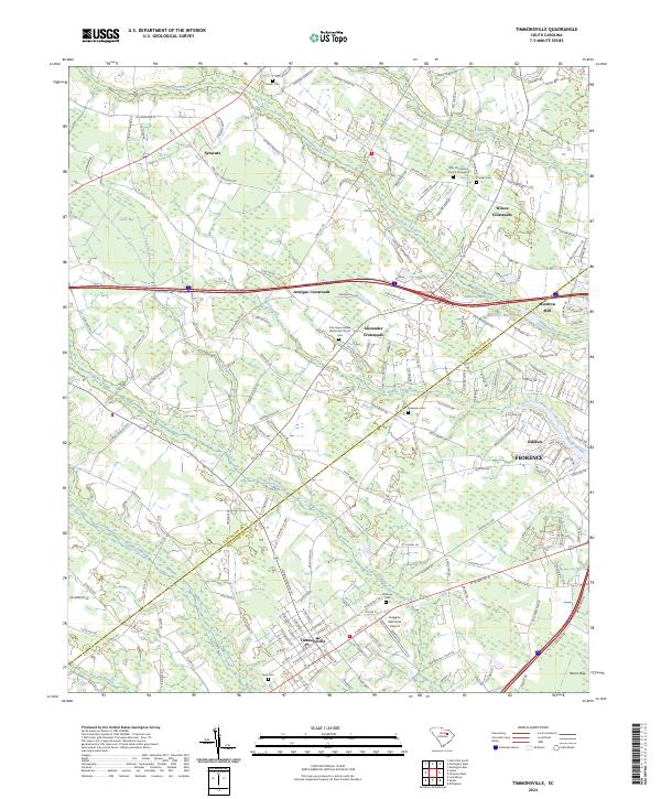
Timmonsville serves as the primary hub in this low-lying region where the Darlington and Florence county lines meet. The landscape is defined by an intricate network of wetlands, including the expansive Lake Swamp, Middle Swamp, and Sparrow Swamp, which shape the local road patterns and settlement boundaries. Smaller communities and rural intersections such as Syracuse, Wilson Crossroads, and Alexander Crossroads highlight the agricultural and residential pockets established between these waterways. Industrial and transport history is visible at Muldrow Mill and its associated Muldrow Mill Pond along Jeffries Creek, alongside the more modern footprint of the Huggins Memorial Airport. Family history is deeply rooted here, evidenced by several scattered burial grounds including Byrd Cem, Sansbury Cem, and the New Providence Church Graveyard, which preserve the names of early residents.
Find a feature on this map
171 named features on this map. Tap any name to fly to it.
Don’t see what you’re looking for? This feature index may not catch every label — zoom into the map to look around manually.
Map Details
Editions of this 2024 Timmonsville Map
This is the sole edition of this map. No revisions or reprints were ever made.