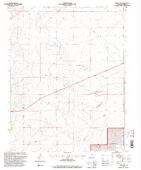
1996 Map of Timpas NW
USGS Topo · Published 2000About this map
Comanche National Grassland dominates the southeastern corner of this Otero County landscape, representing a protected portion of the Great Plains as it appeared in the mid-1990s. The region is characterized by an extensive water management system designed for livestock and land use, featuring a series of numbered catchments including Swink Reservoir No 2, Swink Reservoir No 5, and Swink Reservoir No 6. These reservoirs are linked by a network of earthen structures labeled Levee and subterranean Pipeline routes. Scattered throughout the terrain are critical water access points for ranching, such as the Harbeck Windmill and the aptly named Big Well and Good Well. This survey captures a rural environment where infrastructure like the Communication Tower and a Flowing Well serve as modern landmarks amidst the vast western open space.
Find a feature on this map
13 named features on this map. Tap any name to fly to it.
Don’t see what you’re looking for? This feature index may not catch every label — zoom into the map to look around manually.
Map Details
Editions of this 1996 Timpas NW Map
This is the sole edition of this map. No revisions or reprints were ever made.
Other maps of this area

1891 · Catlin
USGS Topo · 1:125,000

1891 · Timpas
USGS Topo · 1:125,000

1891 · Nepesta
USGS Topo · 1:125,000

1891 · Apishapa
USGS Topo · 1:125,000

1893 · Nepesta
USGS Topo · 1:125,000

1893 · Apishapa
USGS Topo · 1:125,000

1893 · Catlin
USGS Topo · 1:125,000

1894 · Timpas
USGS Topo · 1:125,000

1897 · Apishapa
USGS Topo · 1:125,000

1904 · Nepesta
USGS Topo · 1:125,000