1955 Map of Timpie
USGS Topo · Published 1957About this map
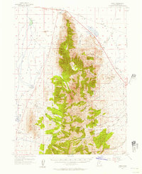
The northern terminus of the Stansbury Mountains dominates this mid-century topographic survey, where the peaks drop sharply toward the Great Salt Lake desert. The settlement of Timpie sits at the junction of the Western Pacific and Union Pacific rail lines, marking a vital transportation node on the edge of the salt flats. This landscape is defined by the stark contrast between the high summits of the Wasatch National Forest and the low, saline basins of Skull Valley to the west. The map records the network of springs and canyons, such as Muskrat Spring and Box Canyon, that provided critical water sources in an otherwise arid region. These features illustrate the precarious balance of ranching and transit operations that sustained local life before the expansion of modern interstate infrastructure altered the corridor's character.
Find a feature on this map
1 named feature on this map. Tap any name to fly to it.
Don’t see what you’re looking for? This feature index may not catch every label — zoom into the map to look around manually.
Map Details
Editions of this 1955 Timpie Map
2 editions found

Other maps of this area

1885 · Tooele Valley
USGS Topo · 1:250,000

1918 · Stockton
USGS Topo · 1:62,500

1953 · Tooele
USGS Topo · 1:250,000
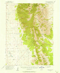
1955 · Deseret Peak
USGS Topo · 1:62,500

1955 · Burmester
USGS Topo · 1:24,000
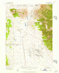
1955 · Grantsville
USGS Topo · 1:24,000
1955 · Stockton
USGS Topo · 1:62,500

1955 · Tooele
USGS Topo · 1:250,000

1968 · Poverty Point
USGS Topo · 1:24,000

1968 · Corral Canyon
USGS Topo · 1:24,000