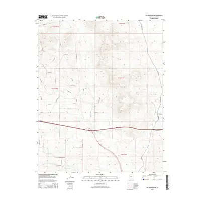
2014 Map of Tin Mountain NW
USGS Topo · Published 2014About this map
The high desert landscape of Mohave County is defined by a network of seasonal drainages and a modern grid of rural residential development. Peacock Wash and McGarrys Wash carve paths through the southern reaches, serving as primary hydrological features in this arid environment. The road network reflects a late-20th-century transition toward desert living, with uniquely named thoroughfares such as N Quail Nest Rd, E Blue Dog Rd, and Gila Monster Rd branching off from more established routes. This infrastructure follows the natural topography, navigating around prominent elevations via corridors like N Friendship Pass. The intersection of traditional range land and modern housing is evident in labels like E Horseback Trl and E Rodeo Dr, illustrating how the area's equestrian and ranching roots were preserved in its contemporary naming conventions.
Find a feature on this map
48 named features on this map. Tap any name to fly to it.
Don’t see what you’re looking for? This feature index may not catch every label — zoom into the map to look around manually.
Map Details
Editions of this 2014 Tin Mountain NW Map
This is the sole edition of this map. No revisions or reprints were ever made.
Other maps of this area
1886 · Diamond Creek
USGS Topo · 1:250,000
1892 · Diamond Creek
USGS Topo · 1:250,000
1948 · Williams
USGS Topo · 1:250,000
1954 · Williams
USGS Topo · 1:250,000
1956 · Williams
USGS Topo · 1:250,000
1960 · Williams
USGS Topo · 1:250,000
1961 · Williams
USGS Topo · 1:250,000
1968 · Austin Peak
USGS Topo · 1:24,000
1968 · Peacock Peak
USGS Topo · 1:24,000
1968 · Hualapai Peak NE
USGS Topo · 1:24,000