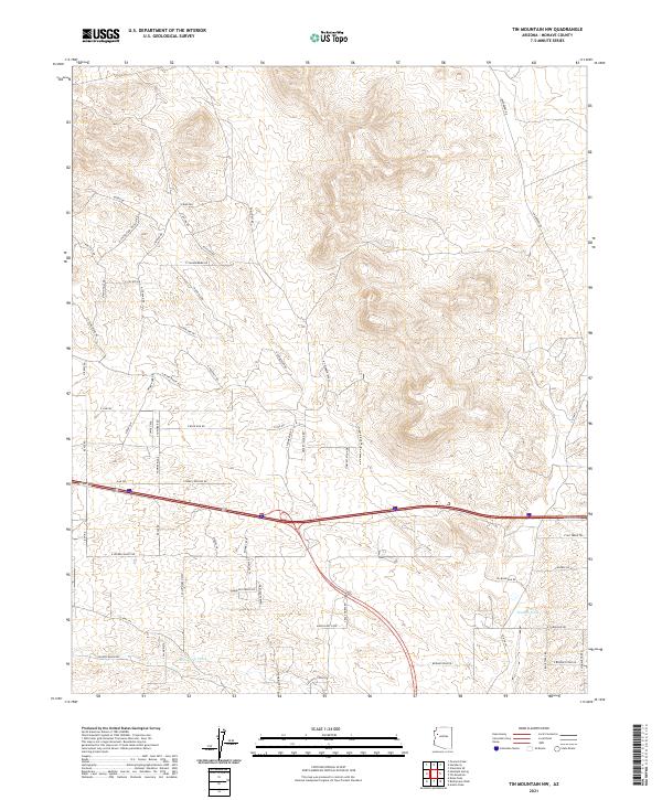
2021 Map of Tin Mountain NW
USGS Topo · Published 2021About this map
Peacock Wash and McGarrus Wash cut through the high desert drainage of this Mohave County quadrangle, where the landscape is defined by a grid of rural residential tracks and winding mountain roads. The presence of Towhee Ridge and Windy Ridge Dr indicates the elevated, exposed terrain common to this part of the Hualapai Valley region. The map shows a late-modern stage of rural development, marked by evocative street names like Harvest Moon Dr, Desert Island Rd, and N Friendship Pass. A dense network of local roads including E Blake Ranch Rd and E Thunderbird Dr suggests a transition from traditional ranching lands to established rural homesites and small-acreage properties. Researchers of local land use can trace the intersection of section lines and contemporary access routes that have reshaped this arid environment.
Find a feature on this map
68 named features on this map. Tap any name to fly to it.
Don’t see what you’re looking for? This feature index may not catch every label — zoom into the map to look around manually.
Map Details
Editions of this 2021 Tin Mountain NW Map
This is the sole edition of this map. No revisions or reprints were ever made.
Other maps of this area

1886 · Diamond Creek
USGS Topo · 1:250,000

1892 · Diamond Creek
USGS Topo · 1:250,000

1948 · Williams
USGS Topo · 1:250,000

1954 · Williams
USGS Topo · 1:250,000

1956 · Williams
USGS Topo · 1:250,000

1960 · Williams
USGS Topo · 1:250,000

1961 · Williams
USGS Topo · 1:250,000
1968 · Austin Peak
USGS Topo · 1:24,000
1968 · Peacock Peak
USGS Topo · 1:24,000
1968 · Hualapai Peak NE
USGS Topo · 1:24,000