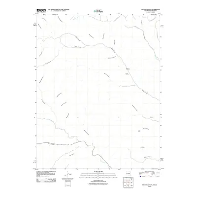
2010 Map of Tin Pan Canyon
USGS Topo · Published 2010About this map
The Brilliant settlement and its namesake Brilliant Coal Mine anchor this northern New Mexico terrain, where the landscape is defined by a dense network of high-desert drainages. Industrial history is etched into the earth through sites like the Dutchman Coal Mine, Bartlett Mine, and Blossburg Number Four, which sit among the numerous canyons that give the region its character. The Canadian River cuts through the southern portion of the quadrangle, joined by tributaries such as Gallinas Creek and Dillon Canyon. The transport network includes the storied Old Raton Pass Rd and Coal Canyon Rd, which follow natural contours between prominent landmarks like Tin Pan Canyon and Rockhouse Canyon. This topography reflects a century of resource extraction and mountain transit near the Colorado border.
Find a feature on this map
35 named features on this map. Tap any name to fly to it.
Don’t see what you’re looking for? This feature index may not catch every label — zoom into the map to look around manually.
Map Details
Editions of this 2010 Tin Pan Canyon Map
This is the sole edition of this map. No revisions or reprints were ever made.
Other maps of this area

1891 · Spanish Peaks
USGS Topo · 1:125,000

1892 · Elmoro
USGS Topo · 1:125,000

1893 · Spanish Peaks
USGS Topo · 1:125,000

1893 · Elmoro
USGS Topo · 1:125,000

1895 · Spanish Peaks
USGS Topo · 1:125,000

1897 · Elmoro
USGS Topo · 1:125,000

1897 · Spanish Peaks
USGS Topo · 1:125,000

1900 · Spanish Peaks
USGS Topo · 1:125,000

1912 · Raton
USGS Topo · 1:62,500

1914 · Raton
USGS Topo · 1:62,500