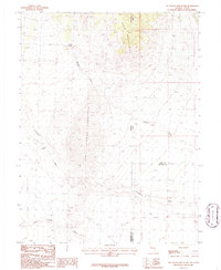
1986 Map of Tin Springs Mountain
USGS Topo · Published 1986About this map
Tin Springs Mountain dominates the center of this 1986 provisional survey, which straddles the high desert border between Nevada and Utah. The landscape is defined by the elevation shift from the Little Valley floor toward the northern heights of the Kern Mountains. Arid drainage patterns are meticulously mapped, showing the intricate course of Sulphur Wash, Tungstonia Wash, and Indian George Wash as they navigate the slopes.
Find a feature on this map
12 named features on this map. Tap any name to fly to it.
Don’t see what you’re looking for? This feature index may not catch every label — zoom into the map to look around manually.
Map Details
Editions of this 1986 Tin Springs Mountain Map
This is the sole edition of this map. No revisions or reprints were ever made.
Other maps of this area

1908 · Fish Springs
USGS Topo · 1:250,000

1910 · Fish Springs
USGS Topo · 1:250,000

1953 · Delta
USGS Topo · 1:250,000

1956 · Ely
USGS Topo · 1:250,000

1958 · Delta
USGS Topo · 1:250,000

1959 · Ely
USGS Topo · 1:250,000

1960 · Gandy
USGS Topo · 1:62,500

1961 · Trout Creek
USGS Topo · 1:62,500

1962 · Delta
USGS Topo · 1:250,000

1963 · Ely
USGS Topo · 1:250,000