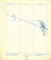
1982 Map of Tinajas Altas
USGS Topo · Published 1982About this map
The International Boundary between the United States and Mexico cuts a sharp diagonal through the arid landscape of the Yuma Desert in this military control sheet. Surveyed by the Corps of Engineers and based on earlier control from the International Boundary Commission, the map focuses on the stark topography of the Tinajas Mountains and the Sierra de la Lechuguilla. A series of numbered boundary markers, such as Mon. 199 and Mon. 190, track the political divide across the Sand Hills. Notable for desert travelers, the Tinajas Altas region highlights critical water sources or Tinajas found within the mountains. Primitive roads and trails connect this remote borderland to distant points, with routes marked From Yuma, To Gila River, and To Tule Wells, reflecting the region's historical reliance on established desert tracks.
Find a feature on this map
20 named features on this map. Tap any name to fly to it.
Don’t see what you’re looking for? This feature index may not catch every label — zoom into the map to look around manually.
Map Details
Editions of this 1982 Tinajas Altas Map
This is the sole edition of this map. No revisions or reprints were ever made.
Other maps of this area

1903 · Yuma
USGS Topo · 1:125,000

1905 · Yuma
USGS Topo · 1:125,000

1926 · Fortuna
USGS Topo · 1:62,500

1926 · Wellton
USGS Topo · 1:62,500

1926 · Mohawk
USGS Topo · 1:62,500

1928 · Mohawk
USGS Topo · 1:62,500

1929 · Fortuna
USGS Topo · 1:62,500

1929 · Wellton
USGS Topo · 1:62,500

1940 · Yuma
USGS Topo · 1:62,500

1942 · Yuma
USGS Topo · 1:250,000