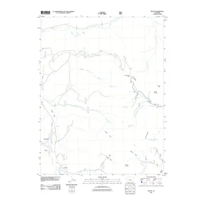
2011 Map of Tincup
USGS Topo · Published 2011About this map
Tincup and Abbeyville sit at the southern edge of Taylor Park, marking a high-elevation landscape defined by historical mining and the rugged spine of the Sawatch Range. In this 2011 survey, the intricate drainage patterns of Willow Creek and East Willow Creek are clearly delineated as they flow toward the park, while the legacy of early extraction is evident at the Iron Ore Lode Mine and Garden Mine. The eastern boundary is defined by the Continental Divide, where Cottonwood Pass provides a crossing near Turner Peak and Jones Mountain. This modern topographic study reveals a terrain of high basins like Sanford Basin and Mineral Basin, and numerous alpine water bodies including Ptarmigan Lake, Spout Lake, and the Texas Lakes. The road network, including Co RD 765 and State HWY 306, provides access to these remote reaches of the Gunnison National Forest, showing the connection between the historic settlements and the surrounding mountain peaks.
Find a feature on this map
40 named features on this map. Tap any name to fly to it.
Don’t see what you’re looking for? This feature index may not catch every label — zoom into the map to look around manually.
Map Details
Editions of this 2011 Tincup Map
This is the sole edition of this map. No revisions or reprints were ever made.
Other maps of this area

1934 · Taylor Park
USGS Topo · 1:62,500

1937 · Taylor Park
USGS Topo · 1:62,500

1940 · Garfield
USGS Topo · 1:62,500

1941 · Pitkin
USGS Topo · 1:62,500

1945 · Pitkin
USGS Topo · 1:62,500

1945 · Garfield
USGS Topo · 1:62,500

1955 · Mount Harvard
USGS Topo · 1:62,500

1956 · Montrose
USGS Topo · 1:250,000

1959 · Montrose
USGS Topo · 1:250,000

1960 · Montrose
USGS Topo · 1:250,000