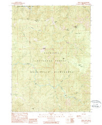
1989 Map of Tincup Peak
USGS Topo · Published 1989About this map
The Illinois National Wild and Scenic River and the upper reaches of the Chetco River dominate this 1989 topographic study of the Siskiyou Mountains. This remote landscape is defined by its placement within the Siskiyou National Forest and the Kalmiopsis Wilderness, showing a terrain where drainage patterns like Tincup Creek and Box Canyon Creek dictate the geography. Cultural markers are few, yet significant for local history, including the Cedar Camp (Site) and river features such as Chetco Bar and Taggarts Bar. High-altitude landmarks like Mount Billingslea, Tincup Peak, and Granite Butte provide a framework for the drainage basins of the Gold Basin and Klondike Creek. The map also captures the administrative boundary between Josephine and Curry counties as it traverses high ridges like Tincup Pass.
Find a feature on this map
26 named features on this map. Tap any name to fly to it.
Don’t see what you’re looking for? This feature index may not catch every label — zoom into the map to look around manually.
Map Details
Editions of this 1989 Tincup Peak Map
This is the sole edition of this map. No revisions or reprints were ever made.
Other maps of this area

1917 · Kerby
USGS Topo · 1:125,000

1918 · Kerby
USGS Topo · 1:125,000

1945 · Kerby
USGS Topo · 1:125,000

1954 · Coos Bay
USGS Topo · 1:250,000

1954 · Chetco Peak
USGS Topo · 1:62,500

1954 · Collier Butte
USGS Topo · 1:62,500

1954 · Mt. Emily
USGS Topo · 1:62,500

1954 · Pearsoll Peak
USGS Topo · 1:62,500

1955 · Medford
USGS Topo · 1:250,000

1957 · Medford
USGS Topo · 1:250,000