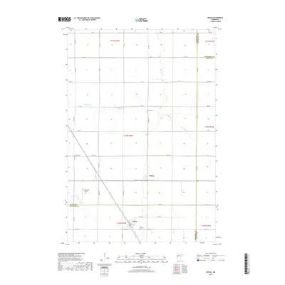
2019 Map of Tintah
USGS Topo · Published 2019About this map
The agricultural landscape of Tintah and Nashua defines this portion of the Red River Valley at the intersection of Wilkin, Traverse, Otter Tail, and Grant Counties. This modern survey illustrates the expansive grid system of townships and ranges, where the drainage of the Rabbit River and S Fork Rabbit River meanders across nearly level terrain. Historically significant for local families, the map identifies Saint Galls Cem south of the Tintah settlement and Riverside Cem located further north along the riverbanks. The influence of transport and aviation is visible through the diagonal rail corridor and the presence of Wetenkamp Airport. While much of the area is dedicated to large-scale farming, the network of township roads like TWP RD 120 and TWP RD 158 provides a detailed look at the rural connectivity that has sustained these small Minnesota communities for generations.
Find a feature on this map
54 named features on this map. Tap any name to fly to it.
Don’t see what you’re looking for? This feature index may not catch every label — zoom into the map to look around manually.
Map Details
Editions of this 2019 Tintah Map
This is the sole edition of this map. No revisions or reprints were ever made.
Other maps of this area

1910 · Wendell
USGS Topo · 1:62,500

1911 · Herman
USGS Topo · 1:62,500

1913 · Wendell
USGS Topo · 1:62,500

1951 · Wheaton
USGS Topo · 1:62,500

1951 · Campbell
USGS Topo · 1:62,500

1953 · Milbank
USGS Topo · 1:250,000

1953 · Fargo
USGS Topo · 1:250,000

1956 · Fargo
USGS Topo · 1:250,000

1958 · Milbank
USGS Topo · 1:250,000

1973 · Herman NW
USGS Topo · 1:24,000