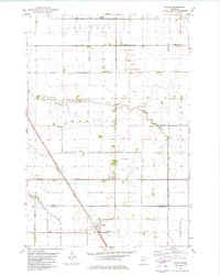
1981 Map of Tintah
USGS Topo · Published 1982About this map
The village of Tintah and the town of Nashua anchor this survey of the Red River Valley borderlands in the early 1980s. This agricultural landscape is defined by an intricate network of water management, where the naturally meandering Rabbit River and South Fork Rabbit River are augmented by extensive drainage systems like Judicial Ditch No 7 and County Ditch No 20. The map documents a critical transportation junction where the Soo Line, Western, and Burlington Northern railroads converge to serve the region's grain-producing economy.
Find a feature on this map
26 named features on this map. Tap any name to fly to it.
Don’t see what you’re looking for? This feature index may not catch every label — zoom into the map to look around manually.
Map Details
Editions of this 1981 Tintah Map
This is the sole edition of this map. No revisions or reprints were ever made.
Other maps of this area

1910 · Wendell
USGS Topo · 1:62,500

1911 · Herman
USGS Topo · 1:62,500

1913 · Wendell
USGS Topo · 1:62,500

1951 · Wheaton
USGS Topo · 1:62,500

1951 · Campbell
USGS Topo · 1:62,500

1953 · Milbank
USGS Topo · 1:250,000

1953 · Fargo
USGS Topo · 1:250,000

1956 · Fargo
USGS Topo · 1:250,000

1958 · Milbank
USGS Topo · 1:250,000

1973 · Herman NW
USGS Topo · 1:24,000