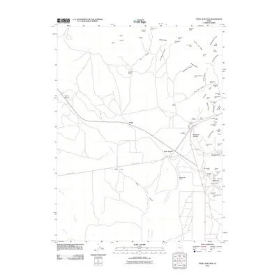
2010 Map of Tintic Junction
USGS Topo · Published 2010About this map
Silver City and Mammoth anchor the eastern slopes of the Tintic Mountains in this 2010 survey of Utah's historic mining country. The landscape is heavily marked by a dense concentration of mineral extraction sites, reflecting the region's industrial heritage through features like the Yankee Girl Mine, Swansea Mine, and General Logan Mine. These operations follow the distinct geological folds of Eureka Ridge and Quartzite Ridge, where the terrain gives way to the open spaces of Wing Flat and the Tintic Valley to the south and west.
Find a feature on this map
73 named features on this map. Tap any name to fly to it.
Don’t see what you’re looking for? This feature index may not catch every label — zoom into the map to look around manually.
Map Details
Editions of this 2010 Tintic Junction Map
This is the sole edition of this map. No revisions or reprints were ever made.
Other maps of this area

1885 · Sevier Desert
USGS Topo · 1:250,000

1885 · Tooele Valley
USGS Topo · 1:250,000

1947 · Fivemile Pass
USGS Topo · 1:62,500

1947 · Allens Ranch
USGS Topo · 1:24,000

1947 · Boulter Peak
USGS Topo · 1:24,000

1949 · Eureka
USGS Topo · 1:24,000

1949 · Allens Ranch
USGS Topo · 1:24,000

1953 · Tooele
USGS Topo · 1:250,000

1953 · Delta
USGS Topo · 1:250,000

1954 · Mc Intyre
USGS Topo · 1:24,000