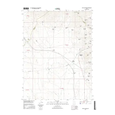
2017 Map of Tintic Junction
USGS Topo · Published 2017About this map
The East Tintic Mountains dominate this region of Utah, revealing a landscape defined by its mining heritage and transit corridors. The historic settlements of Eureka, Mammoth, and Silver City are clustered along the eastern slopes, connected by a network of roads including Main St and Ajax Ave. These towns, along with rail-adjacent points like Tintic Junction and Mammoth Junction, reflect the intense mineral exploration of the Tintic Mining District. Genealogists will find significant value in the mapped locations of the Eureka Cem, Fitch Cem, and Silver City Cem, which anchor the history of these communities. The topography transitions from the high peaks of Hannifin Peak and Old Baldy down into the Tintic Valley, where features like Boulter Summit and Wing Flat mark the more level terrain west of the mountain ridges.
Find a feature on this map
57 named features on this map. Tap any name to fly to it.
Don’t see what you’re looking for? This feature index may not catch every label — zoom into the map to look around manually.
Map Details
Editions of this 2017 Tintic Junction Map
This is the sole edition of this map. No revisions or reprints were ever made.
Other maps of this area

1885 · Sevier Desert
USGS Topo · 1:250,000

1885 · Tooele Valley
USGS Topo · 1:250,000

1947 · Fivemile Pass
USGS Topo · 1:62,500

1947 · Allens Ranch
USGS Topo · 1:24,000

1947 · Boulter Peak
USGS Topo · 1:24,000

1949 · Eureka
USGS Topo · 1:24,000

1949 · Allens Ranch
USGS Topo · 1:24,000

1953 · Tooele
USGS Topo · 1:250,000

1953 · Delta
USGS Topo · 1:250,000

1954 · Mc Intyre
USGS Topo · 1:24,000