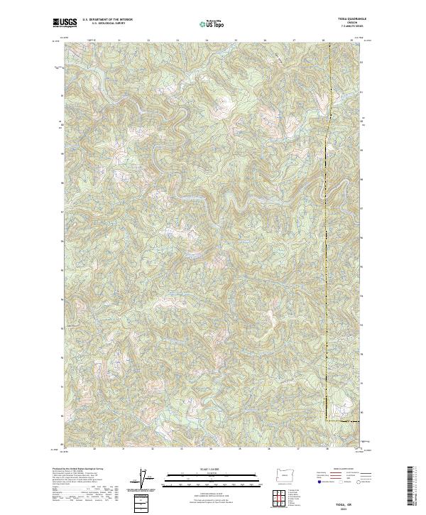
2023 Map of Tioga
USGS Topo · Published 2023About this map
South Fork Coos River and Williams River dominate this portion of the Pacific Northwest, where the drainage systems of the Oregon Coast Range intersect. The landscape is defined by the sharp divide between the Coos Co and Douglas Co line, tracing a series of ridges including the prominent High Ridge. A complex network of forestry roads, such as Callahan Rd and Burnt Ridge Rd, weaves through the steep terrain, providing access to remote locations like Coos Mtn. The map reveals the dense hydrography of the region, from the headwaters of the North Fork Coquille River in the south to the numerous tributaries like Tioga Creek, Shotgun Creek, and Hatcher Creek. These waterways and ridge-top roads suggest a landscape primarily shaped by the timber industry and watershed management, with few permanent settlements but significant naming of the smallest natural features like Cold Springs.
Find a feature on this map
39 named features on this map. Tap any name to fly to it.
Don’t see what you’re looking for? This feature index may not catch every label — zoom into the map to look around manually.
Map Details
Editions of this 2023 Tioga Map
This is the sole edition of this map. No revisions or reprints were ever made.
Other maps of this area

1928 · Sitkum
USGS Topo · 1:125,000

1955 · Camas Valley
USGS Topo · 1:62,500

1955 · Ivers Peak
USGS Topo · 1:62,500

1955 · Sitkum
USGS Topo · 1:62,500

1955 · Tyee
USGS Topo · 1:62,500

1958 · Roseburg
USGS Topo · 1:250,000

1959 · Roseburg
USGS Topo · 1:250,000

1979 · Roseburg
USGS Topo · 1:100,000
1990 · Cedar Creek
USGS Topo · 1:24,000
1990 · Golden Falls
USGS Topo · 1:24,000