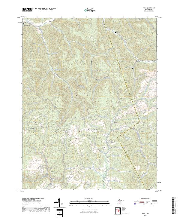
2023 Map of Tioga
USGS Topo · Published 2023About this map
The Birch River flows through the northern reaches of this central West Virginia landscape, providing a geographical anchor for a region defined by its deeply incised valleys and numerous named branches. Small settlements like Tioga and Delphi are situated along winding roads that follow the drainage patterns of Strouds Creek and Big Beaver Creek. The terrain is marked by a complex network of narrow hollows such as Josh Hollow and small forks like Rich Fork and Lick Fork, illustrating the historical reliance on these natural corridors for travel and small-scale habitation.
Find a feature on this map
68 named features on this map. Tap any name to fly to it.
Don’t see what you’re looking for? This feature index may not catch every label — zoom into the map to look around manually.
Map Details
Editions of this 2023 Tioga Map
This is the sole edition of this map. No revisions or reprints were ever made.
Other maps of this area

1889 · Nicholas
USGS Topo · 1:125,000

1891 · Nicholas
USGS Topo · 1:125,000

1893 · Sutton
USGS Topo · 1:125,000

1901 · Nicholas
USGS Topo · 1:125,000

1908 · Gassaway
USGS Topo · 1:48,000

1908 · Sutton
USGS Topo · 1:48,000

1910 · Sutton Special
USGS Topo · 1:62,500

1910 · Gassaway
USGS Topo · 1:62,500

1913 · Summersville
USGS Topo · 1:48,000

1915 · Cowen
USGS Topo · 1:48,000