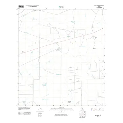
2010 Map of Tios Creek
USGS Topo · Published 2010About this map
La Coma Colonia and the surrounding rangeland of Webb County define this landscape along the South Texas border. The map illustrates a region where water management is central to the land's utility, evidenced by a network of artificial tanks and windmills used to sustain livestock. Features such as Willow Tank, Bad Bottom Tank, and Colorado Flat Tank are scattered across the terrain, alongside Huisache Windmill and Cuates Windmill. The natural drainage of Tios Creek, Lobo Creek, and Becerra Creek provides the structural foundation for the local ranching economy. Settlements and outposts like Pescadito, Mil Ojos Camp, and San Ygnacio Ranch emphasize the rural, spread-out nature of this territory, while a small grid of named streets in the south, including Main and Milagro, indicates the developing residential footprint of the colonia.
Find a feature on this map
33 named features on this map. Tap any name to fly to it.
Don’t see what you’re looking for? This feature index may not catch every label — zoom into the map to look around manually.
Map Details
Editions of this 2010 Tios Creek Map
This is the sole edition of this map. No revisions or reprints were ever made.
Other maps of this area

1933 · Becerra Creek
USGS Topo · 1:62,500

1937 · Aguilete Creek
USGS Topo · 1:62,500

1940 · Aguilares
USGS Topo · 1:62,500

1956 · Laredo East
USGS Topo · 1:62,500

1956 · Laredo
USGS Topo · 1:250,000

1965 · Orvil
USGS Topo · 1:24,000

1965 · Cibolo Ranch
USGS Topo · 1:24,000

1965 · Tios Creek
USGS Topo · 1:24,000

1965 · Laredo East
USGS Topo · 1:24,000

1979 · Laredo South
USGS Topo · 1:24,000