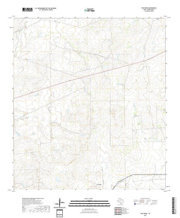
2022 Map of Tios Creek
USGS Topo · Published 2022About this map
La Coma sits at the southern edge of this Webb County landscape, where a sparse network of ranch roads like La Comma Rd and Milagro Rd navigate a terrain defined by intermittent drainage and water management. The mapping reveals an extensive system of man-made tanks, essential for livestock in this semi-arid environment, including Highline Tank, West Novillos Tank, and South Colorado Tank. These features are tied to the natural watercourses that crisscross the area, such as Tios Cr, San Juanito Cr, and Lobo Cr. This 2022 survey provides a clear view of how modern land use persists in South Texas, with large parcels of land intersected by local routes like San Ignacio Rd and the straight line of Railroad St near the settlement at La Coma.
Find a feature on this map
20 named features on this map. Tap any name to fly to it.
Don’t see what you’re looking for? This feature index may not catch every label — zoom into the map to look around manually.
Map Details
Editions of this 2022 Tios Creek Map
This is the sole edition of this map. No revisions or reprints were ever made.
Other maps of this area

1933 · Becerra Creek
USGS Topo · 1:62,500

1937 · Aguilete Creek
USGS Topo · 1:62,500

1940 · Aguilares
USGS Topo · 1:62,500

1956 · Laredo East
USGS Topo · 1:62,500

1956 · Laredo
USGS Topo · 1:250,000

1965 · Orvil
USGS Topo · 1:24,000

1965 · Cibolo Ranch
USGS Topo · 1:24,000

1965 · Tios Creek
USGS Topo · 1:24,000

1965 · Laredo East
USGS Topo · 1:24,000

1979 · Laredo South
USGS Topo · 1:24,000