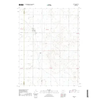
2018 Map of Tipton
USGS Topo · Published 2018About this map
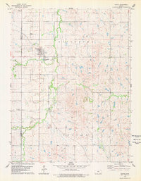
Tipton serves as the central hub of this agricultural landscape in Mitchell County, characterized by a grid of rural roads and scattered watercourses. The town itself is compactly organized around Main St and Iowa St, while local history is marked by the presence of Saint Boniface Cem and Lutheran Cem to the north and south. The terrain is defined by the drainage basins of Carr Cr and Salt Cr, which cut through the plains towards the prominent elevation of Williams Butte. To the south, the Blue Hills provide a distinct geographic boundary. This survey also records modern local landmarks like the Ringneck Ranch Airport, illustrating how traditional land use patterns for farming and ranching persist alongside contemporary aviation and transportation needs.
Find a feature on this map
47 named features on this map. Tap any name to fly to it.
Don’t see what you’re looking for? This feature index may not catch every label — zoom into the map to look around manually.
Map Details
Editions of this 2018 Tipton Map
This is the sole edition of this map. No revisions or reprints were ever made.
Other maps of this area
1894 · Beloit
USGS Topo · 1:125,000
1896 · Osborne
USGS Topo · 1:125,000
1953 · Downs South
USGS Topo · 1:24,000
1953 · Waconda Springs
USGS Topo · 1:24,000
1953 · Glen Elder South
USGS Topo · 1:24,000

1955 · Beloit
USGS Topo · 1:250,000

1959 · Beloit
USGS Topo · 1:250,000
1967 · Hunter
USGS Topo · 1:24,000
1968 · Ash Grove
USGS Topo · 1:24,000
1978 · Tipton
USGS Topo · 1:24,000