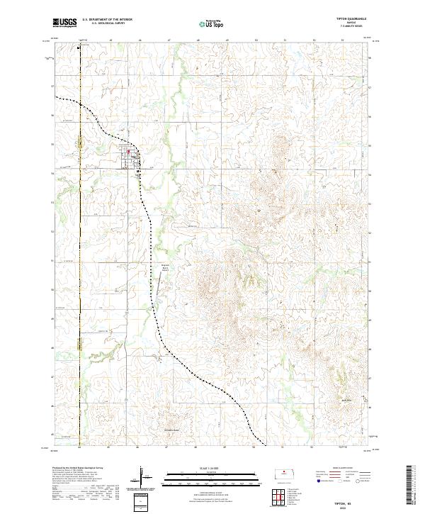
2022 Map of Tipton
USGS Topo · Published 2022About this map
Tipton serves as the primary hub of this North Central Kansas landscape, situated near the boundary between Osborne Co and Mitchell Co. The community's social and historical fabric is anchored by the Saint Boniface Cem and the Lutheran Cem to the north, reflecting the area's pioneer heritage. A grid of section roads like Tipton Rd and O Rd organizes the agricultural terrain, while several waterways including Carr Cr and Salt Cr carve through the land.
Find a feature on this map
45 named features on this map. Tap any name to fly to it.
Don’t see what you’re looking for? This feature index may not catch every label — zoom into the map to look around manually.
Map Details
Editions of this 2022 Tipton Map
This is the sole edition of this map. No revisions or reprints were ever made.
Other maps of this area

1894 · Beloit
USGS Topo · 1:125,000

1896 · Osborne
USGS Topo · 1:125,000

1953 · Downs South
USGS Topo · 1:24,000

1953 · Waconda Springs
USGS Topo · 1:24,000

1953 · Glen Elder South
USGS Topo · 1:24,000

1955 · Beloit
USGS Topo · 1:250,000

1959 · Beloit
USGS Topo · 1:250,000

1967 · Hunter
USGS Topo · 1:24,000
1968 · Ash Grove
USGS Topo · 1:24,000
1978 · Tipton
USGS Topo · 1:24,000