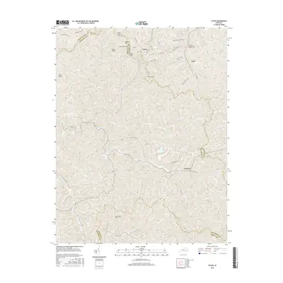
2016 Map of Tiptop
USGS Topo · Published 2016About this map
Tiptop sits at the intersection of Magoffin and Breathitt counties, serving as a high-elevation point of reference within a landscape defined by sharp ridges and deep hollows. The settlement of Evanston anchors the southeastern portion of this survey, reflecting the area's history of extraction and labor indicated by names like Mine Shaft Rd and Silk Stocking Rd. The terrain is characterized by a series of named passes and peaks, including Hogtown Knob, Mullins Gap, and Big Lovely Mtn, which dictated the winding paths of local roads like Roanne Creek Rd and Slusher Branch Rd. Tracing the family-named landmarks such as Jim Prater Cemetery Rd and Nelse Hollow provides insight into the generational ties of this Appalachian region. The intricate network of ridges, such as Half Mountain Ridge, highlights the topographical challenges of navigation between the small communities of Duco and Tiptop during this era.
Find a feature on this map
36 named features on this map. Tap any name to fly to it.
Don’t see what you’re looking for? This feature index may not catch every label — zoom into the map to look around manually.
Map Details
Editions of this 2016 Tiptop Map
This is the sole edition of this map. No revisions or reprints were ever made.
Other maps of this area
1886 · Prestonsburg
USGS Topo · 1:125,000
1889 · Salyersville
USGS Topo · 1:125,000
1890 · Whitesburg
USGS Topo · 1:125,000
1891 · Hazard
USGS Topo · 1:125,000
1891 · Salyersville
USGS Topo · 1:125,000
1892 · Whitesburg
USGS Topo · 1:125,000
1892 · Prestonsburg
USGS Topo · 1:125,000
1899 · Salyersville
USGS Topo · 1:125,000
1912 · Hindman
USGS Topo · 1:48,000
1914 · Troublesome
USGS Topo · 1:62,500