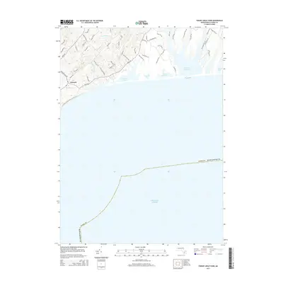
2015 Map of Tisbury Great Pond
USGS Topo · Published 2015About this map
The coastal landscapes of Martha's Vineyard are defined by a rhythmic succession of Great Ponds and narrow finger-like coves along the southern shore of Dukes County. This 2015 survey details the intricate hydrology where the Tiasquam River, Fulling Mill Brook, and Mill Brook descend through the undulating terrain of the Up-Island region toward the Atlantic. The settlement of Chilmark serves as a central landmark, surrounded by a dense network of historically significant thoroughfares like King's Hwy, Meeting House Rd, and Old Fields Path. The map reveals the delicate boundary between the inland freshwater systems and the sea, tracing the expansive shores of Tisbury Great Pond, Chilmark Pond, and Black Point Pond. These features illustrate the intersection of traditional agricultural land use, represented by sites like Tabor Farm, and the preserved coastal ecosystems of the island.
Find a feature on this map
52 named features on this map. Tap any name to fly to it.
Don’t see what you’re looking for? This feature index may not catch every label — zoom into the map to look around manually.
Map Details
Editions of this 2015 Tisbury Great Pond Map
This is the sole edition of this map. No revisions or reprints were ever made.
Other maps of this area

1887 · Gay Head
USGS Topo · 1:62,500

1887 · Marthas Vineyard
USGS Topo · 1:62,500

1889 · Gay Head
USGS Topo · 1:62,500

1889 · Marthas Vineyard
USGS Topo · 1:62,500

1893 · Gay Head
USGS Topo · 1:62,500

1894 · Marthas Vineyard
USGS Topo · 1:62,500

1942 · Marthas Vineyard
USGS Topo · 1:125,000

1944 · Tisbury Great Pond
USGS Topo · 1:31,680

1944 · Vineyard Haven
USGS Topo · 1:31,680
1944 · Naushon Island
USGS Topo · 1:31,680