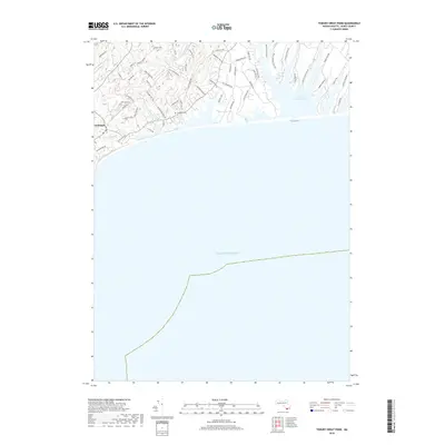
2018 Map of Tisbury Great Pond
USGS Topo · Published 2018About this map
Chilmark and the surrounding coastline of Martha's Vineyard are defined by the intricate finger-like inlets of Tisbury Great Pond and its many branches, such as Quenames Cove and Deep Bottom Cove. This survey reveals a landscape where modern development intertwines with colonial-era land divisions and ancient thoroughfares like The Kings Hwy. The terrain is characterized by numerous small drainages including Fulling Mill Brook and Mill Brook, which feed into the coastal ponds behind the barrier beach facing the Atlantic Ocean. Residential clusters are connected by a network of named ways like Tabor House Rd and Meeting House Rd, reflecting a settlement pattern that balances private estates with open spaces such as Hewing Field and Shadbush Hollow. For genealogists, the Chilmark Cem serves as a central landmark within this township, while the various private roads provide specific geographic context for local family holdings and estates.
Find a feature on this map
58 named features on this map. Tap any name to fly to it.
Don’t see what you’re looking for? This feature index may not catch every label — zoom into the map to look around manually.
Map Details
Editions of this 2018 Tisbury Great Pond Map
This is the sole edition of this map. No revisions or reprints were ever made.
Other maps of this area

1887 · Gay Head
USGS Topo · 1:62,500

1887 · Marthas Vineyard
USGS Topo · 1:62,500

1889 · Gay Head
USGS Topo · 1:62,500

1889 · Marthas Vineyard
USGS Topo · 1:62,500

1893 · Gay Head
USGS Topo · 1:62,500

1894 · Marthas Vineyard
USGS Topo · 1:62,500

1942 · Marthas Vineyard
USGS Topo · 1:125,000

1944 · Tisbury Great Pond
USGS Topo · 1:31,680

1944 · Vineyard Haven
USGS Topo · 1:31,680
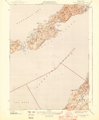
1944 · Naushon Island
USGS Topo · 1:31,680