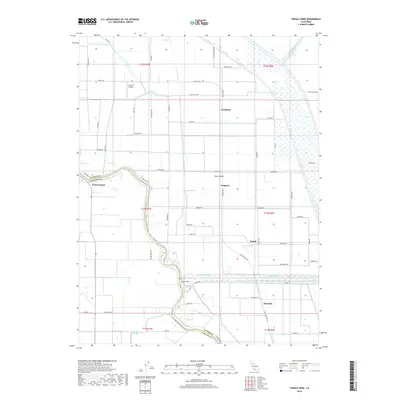
2018 Map of Tisdale Weir
USGS Topo · Published 2018About this map
Sutter Basin is defined by its complex water management infrastructure, most notably the prominent Tisdale Weir and the extensive Tisdale By-Pass. These features, alongside the Sacramento River and Wadsworth Canal, illustrate the engineering required to manage the flood-prone agricultural lands of the Central Valley. The landscape is a network of irrigation and transport, where settlements like Progress, Tisdale, and Joesphine are connected by a rigid grid of rural roads such as Oswald Rd and Robbins Rd. This 2018 survey also identifies localized landmarks like Moronis Airport and several small water bodies including Purdue Lake and Sills Lake. On the western edge, the river forms the boundary between Sutter and Colusa Counties, wrapping around Grand Island. The map reflects a highly controlled agricultural environment where natural sloughs, like Wilkins Slough, persist alongside modern reclamation efforts.
Find a feature on this map
63 named features on this map. Tap any name to fly to it.
Don’t see what you’re looking for? This feature index may not catch every label — zoom into the map to look around manually.
Map Details
Editions of this 2018 Tisdale Weir Map
This is the sole edition of this map. No revisions or reprints were ever made.
Other maps of this area

1888 · Marysville
USGS Topo · 1:125,000

1891 · Marysville
USGS Topo · 1:125,000

1894 · Marysville
USGS Topo · 1:125,000

1895 · Marysville
USGS Topo · 1:125,000

1907 · Dunnigan
USGS Topo · 1:62,500

1910 · Marcuse
USGS Topo · 1:31,680

1911 · Sutter
USGS Topo · 1:31,680

1911 · Grimes
USGS Topo · 1:31,680

1911 · Gilsizer Slough
USGS Topo · 1:31,680

1912 · Marysville Buttes
USGS Topo · 1:31,680