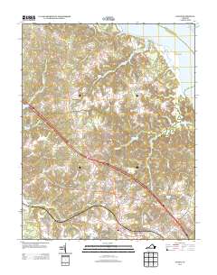
2013 Map of Toano
USGS Topo · Published 2013About this map
Barhamsville and the surrounding James City and New Kent County landscapes are defined by an intricate network of coastal wetlands and low-lying drainage basins. The area is heavily intersected by named swamps such as Richardson Swamp, Wahrani Swamp, and Bird Swamp, which feed into the York River and the large Ware Creek system. Significant civil and industrial features of the early 21st century appear throughout, including the State Prison Camp Number 16 and the Taylor Pit mining operation near the southern edge of the sheet. Modern transportation corridors like Rochambeau Rd and the New Kent Hwy trace older regional routes, connecting established settlements like Toano and Andersons Corner. For researchers, the presence of Branch Siding along the rail line and the distribution of smaller communities like Holly Forks provide a clear view of the rural-to-suburban transition occurring in this historic Virginia Peninsula corridor.
Find a feature on this map
41 named features on this map. Tap any name to fly to it.
Don’t see what you’re looking for? This feature index may not catch every label — zoom into the map to look around manually.
Map Details
Editions of this 2013 Toano Map
This is the sole edition of this map. No revisions or reprints were ever made.
Other maps of this area

1906 · Williamsburg
USGS Topo · 1:62,500

1917 · Urbanna
USGS Topo · 1:62,500

1917 · Toano
USGS Topo · 1:62,500

1918 · Toano
USGS Topo · 1:62,500

1919 · New Kent
USGS Topo · 1:62,500

1943 · Richmond
USGS Topo · 1:250,000

1949 · Shacklefords
USGS Topo · 1:24,000

1949 · New Kent
USGS Topo · 1:24,000

1949 · Richmond
USGS Topo · 1:250,000

1950 · West Point
USGS Topo · 1:24,000