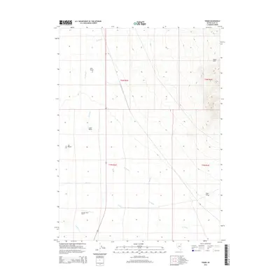
2014 Map of Tobar
USGS Topo · Published 2014About this map
Clover Valley and the open expanse of Tobar Flat dominate this high-desert basin in eastern Nevada. The landscape is defined by its intermittent watercourses and seasonal drainage patterns, most notably The Slough, which wanders across the valley floor alongside Flat-Cypress Cr and Steele Cr. To the west, the foothills of the Pilot Range rise sharply, while the northeast corner captures the edge of the Wood Hills. Human presence is sparse, centered primarily on transportation and aviation, with US Route 93 running north-south through the center of the sheet and the Two Star Ranch Airport providing a remote airstrip in the southwestern quadrant. This map illustrates the intersection of high-altitude basin geography and the infrastructure required for navigating the vast distances of Elko County.
Find a feature on this map
15 named features on this map. Tap any name to fly to it.
Don’t see what you’re looking for? This feature index may not catch every label — zoom into the map to look around manually.
Map Details
Editions of this 2014 Tobar Map
This is the sole edition of this map. No revisions or reprints were ever made.
Other maps of this area
1935 · Halleck
USGS Topo · 1:125,000

1955 · Wells
USGS Topo · 1:250,000

1955 · Elko
USGS Topo · 1:250,000

1958 · Wells
USGS Topo · 1:250,000

1958 · Elko
USGS Topo · 1:250,000

1961 · Wells
USGS Topo · 1:250,000

1962 · Elko
USGS Topo · 1:250,000

1965 · Elko
USGS Topo · 1:250,000
1967 · Welcome
USGS Topo · 1:24,000
1968 · Moor Summit
USGS Topo · 1:24,000