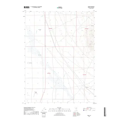
2018 Map of Tobar
USGS Topo · Published 2018About this map
Clover Valley defines the western half of this Nevada landscape, where the seasonal waters of The Slough gather along the base of the Pilot Range. This high-desert basin in Elko County serves as a drainage point for several mountain streams, including Steele Creek and Johnson Creek, which lose their definition as they enter the alluvial flats. The topography shifts dramatically on the eastern edge of the map, rising into the steep, contoured slopes of the Wood Hills.
Find a feature on this map
14 named features on this map. Tap any name to fly to it.
Don’t see what you’re looking for? This feature index may not catch every label — zoom into the map to look around manually.
Map Details
Editions of this 2018 Tobar Map
This is the sole edition of this map. No revisions or reprints were ever made.
Other maps of this area
1935 · Halleck
USGS Topo · 1:125,000

1955 · Wells
USGS Topo · 1:250,000

1955 · Elko
USGS Topo · 1:250,000

1958 · Wells
USGS Topo · 1:250,000

1958 · Elko
USGS Topo · 1:250,000

1961 · Wells
USGS Topo · 1:250,000

1962 · Elko
USGS Topo · 1:250,000

1965 · Elko
USGS Topo · 1:250,000
1967 · Welcome
USGS Topo · 1:24,000
1968 · Moor Summit
USGS Topo · 1:24,000