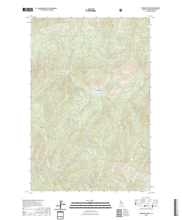
2024 Map of Toboggan Ridge
USGS Topo · Published 2024About this map
Clearwater National Forest defines this high-elevation landscape in Clearwater County, where a complex network of ridges and drainages creates a deeply incised topography. The namesake Toboggan Ridge serves as a central spine, complemented by other prominent landforms such as Little Moose Ridge, Hanson Ridge, and Deer Ridge. These elevations overlook significant natural clearings like Hanson Meadows, which sit along the banks of Kelly Creek. The map documents a wilderness area largely shaped by its hydrology, tracing the paths of numerous named tributaries including Bear Creek, Kodiak Creek, and Cub Creek. This contemporary survey preserves the traditional nomenclature of the region's peaks and waterways, from Toboggan Hill in the west to the southern reaches of Lunde Ridge, providing a detailed spatial record of this remote portion of Idaho's national forest lands.
Find a feature on this map
42 named features on this map. Tap any name to fly to it.
Don’t see what you’re looking for? This feature index may not catch every label — zoom into the map to look around manually.
Map Details
Editions of this 2024 Toboggan Ridge Map
This is the sole edition of this map. No revisions or reprints were ever made.
Other maps of this area

1911 · Lolo
USGS Topo · 1:250,000

1913 · Lolo
USGS Topo · 1:250,000

1956 · Hamilton
USGS Topo · 1:250,000

1959 · Hamilton
USGS Topo · 1:250,000

1960 · Hamilton
USGS Topo · 1:250,000

1960 · Straight Peak
USGS Topo · 1:62,500

1964 · Hamilton
USGS Topo · 1:250,000

1965 · Osier Ridge
USGS Topo · 1:24,000

1965 · Gorman Hill
USGS Topo · 1:24,000

1965 · Horseshoe Lake
USGS Topo · 1:24,000