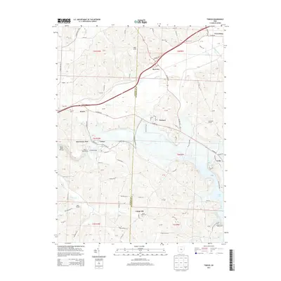
2013 Map of Toboso
USGS Topo · Published 2013About this map
Licking Gorge and the Black Hand Narrows form the dramatic centerpiece of this Licking and Muskingum County borderland, where the Licking River carves through the landscape. The era is marked by the established presence of Dillon State Park and the waters of Dillon Lake to the southeast. Small settlements like Toboso, Nashport, and Black Run are connected by a network of rural roads such as Newark Rd and Blackrun Rd, tracing the paths of earlier pioneers.
Find a feature on this map
91 named features on this map. Tap any name to fly to it.
Don’t see what you’re looking for? This feature index may not catch every label — zoom into the map to look around manually.
Map Details
Editions of this 2013 Toboso Map
This is the sole edition of this map. No revisions or reprints were ever made.
Other maps of this area

1909 · Newark
USGS Topo · 1:62,500

1909 · Thornville
USGS Topo · 1:62,500

1910 · Frazeysburg
USGS Topo · 1:62,500

1910 · Zanesville
USGS Topo · 1:62,500

1947 · Columbus
USGS Topo · 1:250,000

1950 · Marion
USGS Topo · 1:250,000

1961 · Columbus
USGS Topo · 1:250,000

1961 · Hanover
USGS Topo · 1:24,000

1961 · Zanesville West
USGS Topo · 1:24,000
1961 · Glenford
USGS Topo · 1:24,000