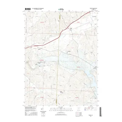
2016 Map of Toboso
USGS Topo · Published 2016About this map
The Licking River carves through the heart of the Licking and Muskingum county line, defining a landscape of dramatic elevation changes and historic river valley settlements. Near the western edge, the river passes through the Licking Gorge and Black Hand Narrows, where landmarks like Black Hand Rock overlook the water. The community of Toboso is situated just north of Rock Haven Park, while the larger village of Frazeysburg occupies the northeastern corner of the map along the Wakatamika Creek corridor.
Find a feature on this map
121 named features on this map. Tap any name to fly to it.
Don’t see what you’re looking for? This feature index may not catch every label — zoom into the map to look around manually.
Map Details
Editions of this 2016 Toboso Map
This is the sole edition of this map. No revisions or reprints were ever made.
Other maps of this area

1909 · Newark
USGS Topo · 1:62,500

1909 · Thornville
USGS Topo · 1:62,500

1910 · Frazeysburg
USGS Topo · 1:62,500

1910 · Zanesville
USGS Topo · 1:62,500

1947 · Columbus
USGS Topo · 1:250,000

1950 · Marion
USGS Topo · 1:250,000

1961 · Columbus
USGS Topo · 1:250,000

1961 · Hanover
USGS Topo · 1:24,000

1961 · Zanesville West
USGS Topo · 1:24,000
1961 · Glenford
USGS Topo · 1:24,000