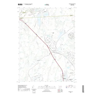
2019 Map of Tobyhanna
USGS Topo · Published 2019About this map
Tobyhanna Army Depot dominates the central landscape of this 2019 survey, a major installation situated among the wetlands and lakes of the Pocono Plateau. The map captures the interface between industrial military infrastructure and vast conservation areas, including Gouldsboro State Park and Tobyhanna State Park. Water defines the region's character, from the headwaters of the Lehigh River in the northwest to the numerous glacially-formed features like Gouldsboro Lake and Bender Swamp.
Find a feature on this map
158 named features on this map. Tap any name to fly to it.
Don’t see what you’re looking for? This feature index may not catch every label — zoom into the map to look around manually.
Map Details
Editions of this 2019 Tobyhanna Map
This is the sole edition of this map. No revisions or reprints were ever made.
Other maps of this area

1889 · Scranton
USGS Topo · 1:62,500

1891 · Scranton
USGS Topo · 1:62,500

1893 · Scranton
USGS Topo · 1:62,500

1919 · Pocono
USGS Topo · 1:62,500

1921 · Pocono
USGS Topo · 1:62,500

1922 · Stoddartsville
USGS Topo · 1:62,500

1923 · Pocono
USGS Topo · 1:62,500

1924 · Stoddartsville
USGS Topo · 1:62,500

1928 · Ariel
USGS Topo · 1:62,500

1932 · Ariel
USGS Topo · 1:62,500
Featured Places
- Tobyhanna, Coolbaugh Township
- Clifton Township, PA
- Dreher Township, PA
- Pocono Pines, Tobyhanna Township
- Coolbaugh Township, PA