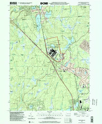
1999 Map of Tobyhanna
USGS Topo · Published 2002About this map
The US Military Reservation Tobyhanna Army Depot dominates the central landscape of the Pocono Mountains at the turn of the millennium. This logistical hub is surrounded by the vast wetlands of the Lehigh Plateau, including the massive Huckleberry Marsh and Big Marsh. The settlement of Tobyhanna serves as a local focal point near the Conrail line, while planned residential communities like Lynchwood Lake and Stillwater Lake Estates show the region's growth as a recreational and residential destination. Large tracts of protected land, such as State Game Lands No 127 and Tobyhanna State Park, preserve the headwaters of Tobyhanna Creek. To the south, the Pocono Mountains Municipal Airport and Pocono Mountain School indicate the modern infrastructure supporting the community of Pocono Summit.
Find a feature on this map
84 named features on this map. Tap any name to fly to it.
Don’t see what you’re looking for? This feature index may not catch every label — zoom into the map to look around manually.
Map Details
Editions of this 1999 Tobyhanna Map
This is the sole edition of this map. No revisions or reprints were ever made.
Other maps of this area

1889 · Scranton
USGS Topo · 1:62,500

1891 · Scranton
USGS Topo · 1:62,500

1893 · Scranton
USGS Topo · 1:62,500

1919 · Pocono
USGS Topo · 1:62,500

1921 · Pocono
USGS Topo · 1:62,500

1922 · Stoddartsville
USGS Topo · 1:62,500

1923 · Pocono
USGS Topo · 1:62,500

1924 · Stoddartsville
USGS Topo · 1:62,500

1928 · Ariel
USGS Topo · 1:62,500

1932 · Ariel
USGS Topo · 1:62,500
Featured Places
- Tobyhanna, Coolbaugh Township
- Clifton Township, PA
- Pocono Pines, Tobyhanna Township
- Dreher Township, PA
- Tobyhanna Township, PA