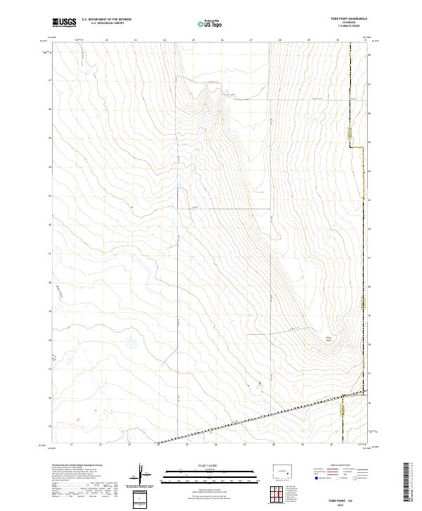
2022 Map of Todd Point
USGS Topo · Published 2022About this map
Todd Point stands as the primary namesake landmark in this open expanse of southeastern Colorado, where the high plains meet complex county boundaries. Surveyed by the U.S. Geological Survey, this map illustrates a landscape primarily defined by its drainage patterns and a sparse, rectilinear road network. The intermittent watercourse of Black Draw cuts through the western sections, while the rest of the terrain is partitioned by surveyed township and range lines. The intersections of Crowley and Kiowa counties, along with the Crowley and Otero county line, highlight the jurisdictional complexity of this rural ranching region. Local travel is facilitated by a grid of rural routes including Co Ln 29 and Co Rd S 5/10, which serve the expansive agricultural and grazing lands between the few named geographical features.
Find a feature on this map
21 named features on this map. Tap any name to fly to it.
Don’t see what you’re looking for? This feature index may not catch every label — zoom into the map to look around manually.
Map Details
Editions of this 2022 Todd Point Map
This is the sole edition of this map. No revisions or reprints were ever made.
Other maps of this area

1891 · Catlin
USGS Topo · 1:125,000

1891 · Las Animas
USGS Topo · 1:125,000

1893 · Las Animas
USGS Topo · 1:125,000

1893 · Catlin
USGS Topo · 1:125,000

1954 · Meredith Hill
USGS Topo · 1:24,000

1954 · Sugar City
USGS Topo · 1:24,000

1954 · Lamar
USGS Topo · 1:250,000
1955 · Lewis Ranch
USGS Topo · 1:24,000

1958 · Lamar
USGS Topo · 1:250,000
1977 · The Pinnacles
USGS Topo · 1:24,000