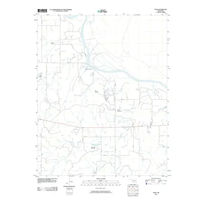
2010 Map of Togo
USGS Topo · Published 2010About this map
The Cimarron River winds through this rural landscape in Major County, Oklahoma, defining a terrain shaped by water and energy extraction. This 2010 survey highlights a region where natural features like Lone Mountain and Griever Creek meet modern infrastructure, including the East Campbell Gas Field. For those researching local history or genealogy, the map identifies specific burial grounds such as Lone Star Cemetery in the north and Connor Cemetery near the southern border. Water management is a significant theme here, evidenced by several small impoundments like Callison Lake and Bell Lake, each with its own dam, alongside the larger Oknoname 093005 Reservoir which collects drainage from the surrounding plains.
Find a feature on this map
28 named features on this map. Tap any name to fly to it.
Don’t see what you’re looking for? This feature index may not catch every label — zoom into the map to look around manually.
Map Details
Editions of this 2010 Togo Map
This is the sole edition of this map. No revisions or reprints were ever made.
Other maps of this area

1955 · Woodward
USGS Topo · 1:250,000

1958 · Woodward
USGS Topo · 1:250,000

1969 · Phroso
USGS Topo · 1:24,000

1969 · Belva
USGS Topo · 1:24,000

1969 · Dacoma SW
USGS Topo · 1:24,000

1969 · Glass Mountains NW
USGS Topo · 1:24,000

1969 · Waynoka East
USGS Topo · 1:24,000

1969 · Cedardale
USGS Topo · 1:24,000

1969 · Togo
USGS Topo · 1:24,000

1969 · Waynoka West
USGS Topo · 1:24,000