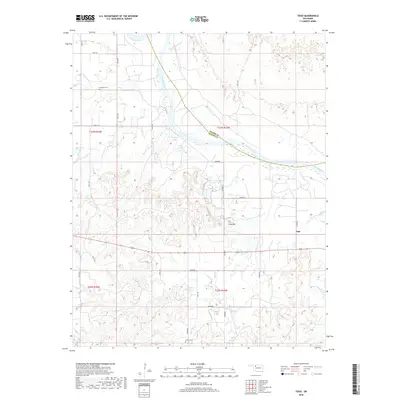
2018 Map of Togo
USGS Topo · Published 2018About this map
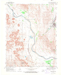
The Cimarron River carves a broad valley through the northern landscape of Major and Woods Counties, creating a complex system of seasonal wetlands and creek crossings. The small settlement of Togo sits near the eastern edge of the quadrangle, serving as a landmark in a region defined by its wide-ranging agricultural sections and the prominent rise of Lone Mtn. This 2018 survey reveals a terrain shaped by water management and family history, with the G93005 Reservoir and Callison Lake punctuating the drainage basins of Griever Cr and Walnut Grove Cr. Genealogists and local historians can locate early burial grounds such as Lone Star Cem in the northwest and Connor Cem to the south. The map documents the persistent grid of rural roads, including n2360 RD and e0400 RD, that provide access to this quiet corner of the Oklahoma prairie, where the natural bend of the river dictates the local geography.
Find a feature on this map
32 named features on this map. Tap any name to fly to it.
Don’t see what you’re looking for? This feature index may not catch every label — zoom into the map to look around manually.
Map Details
Editions of this 2018 Togo Map
This is the sole edition of this map. No revisions or reprints were ever made.
Other maps of this area

1955 · Woodward
USGS Topo · 1:250,000

1958 · Woodward
USGS Topo · 1:250,000
1969 · Phroso
USGS Topo · 1:24,000
1969 · Belva
USGS Topo · 1:24,000
1969 · Dacoma SW
USGS Topo · 1:24,000
1969 · Glass Mountains NW
USGS Topo · 1:24,000
1969 · Waynoka East
USGS Topo · 1:24,000
1969 · Cedardale
USGS Topo · 1:24,000
1969 · Togo
USGS Topo · 1:24,000
1969 · Waynoka West
USGS Topo · 1:24,000